The Columbia River at
The Deschutes River, Oregon
The Columbia River at The Deschutes River, 2021 — Ink, watercolor, algae pigment, and forest fire charcoal on paper
My first location and the first inspiration for artwork is the Columbia River in Oregon. The Ehrenberg database lists the following:
. . . among Confervae [filamentous algae] found on a Unis from Colombia River Oregon.
Little is known about these specific sample locations. The Ehrenberg collection database references other samples associated with the Frémont expeditions of 1843 and 1844, which tracks both the general locations and place names used in the database. During this time, national and territory borders were very much in flux. Washington Territory and the final borders between Canada and the United States were established in 1853, well after the likely sample dates used for these illustrations.
The database dates the Columbia River samples to 1845, which may just note the year these references were received.
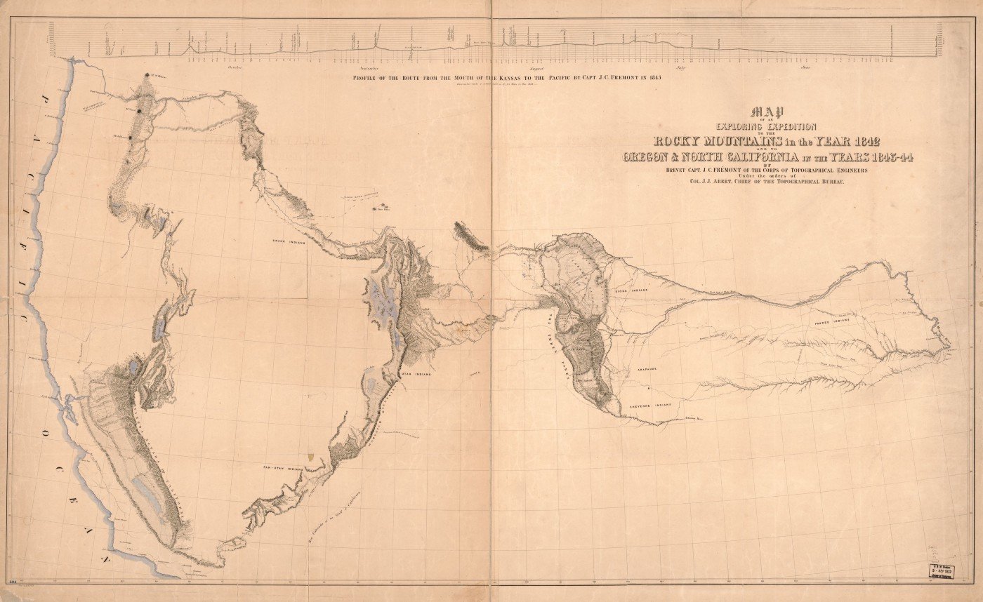
Map of Frémont Expedition surveying California and Oregon, 1843–44, Library of Congress
Much of my re-tracing sample locations requires some educated guesswork. Based on the Frémont Expedition maps, I picked likely locations for sampling. Oregon Territory would have been largely populated by Umatilla, Walla Walla, Cayuse, Paiute, and Wasco people at the time, with many more nations utilizing the area. The Dalles, one of the few colonial settlements in the area, would have been a likely stop for the Frémont Expedition to gather supplies, rest, and collect scientific samples.
The mouth of the Deschutes River at the Columbia River. This was a popular Oregon Trail crossing location and is today the site of a highway and railroad bridge.
I took this sample from Heritage Landing Park outside of The Dalles, OR. This location was described by Lewis and Clark and would have been a likely place to sample both the Columbia and the Deschutes Rivers. This particular site was a popular crossing for emigrants on the Oregon Trail, described below by one such traveler.
“Danger attends the crossage here … many large rocks and at the same time a very rapid current.” — John McAllister, 1852
Access to historical sites is often challenging, with many sites now subsumed by agriculture, railroad, and private use. This particular site is preserved as a state park as well as First Nations fishing access, so I was very lucky to sample extremely close to what I believe was a collection site.
Sample taken of the Deschutes River at the Columbia River. This sample represents the microbiome of both bodies of water. Note the small rocky bars in the distance that would have been used by wagon trains to cross the Deschutes at this location. Sampled July 2021.
Historic postcard of the railroad bridge that is still standing today at the mouth of the Deschutes River.
Dr. Ehrenberg’s observations
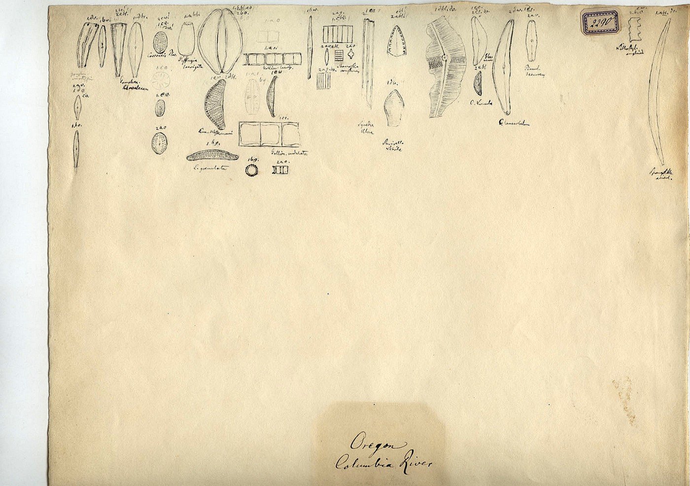
Columbia River, Oregon organisms observed by Dr. Ehrenberg. Image used with permission from the Natural History Museum of Berlin.
Dr. Ehrenberg’s illustrations have several species such as Cymbella (shown as a fragment in the illustration), Encyonema, Cocconeis, testate Amoeba, Gomphonema, and many other diatoms. The source sample for the mica slides and illustrations was likely a dry card sample since these organisms were described as being among filamentous algae which quickly disintegrates in aqueous samples.
My observations
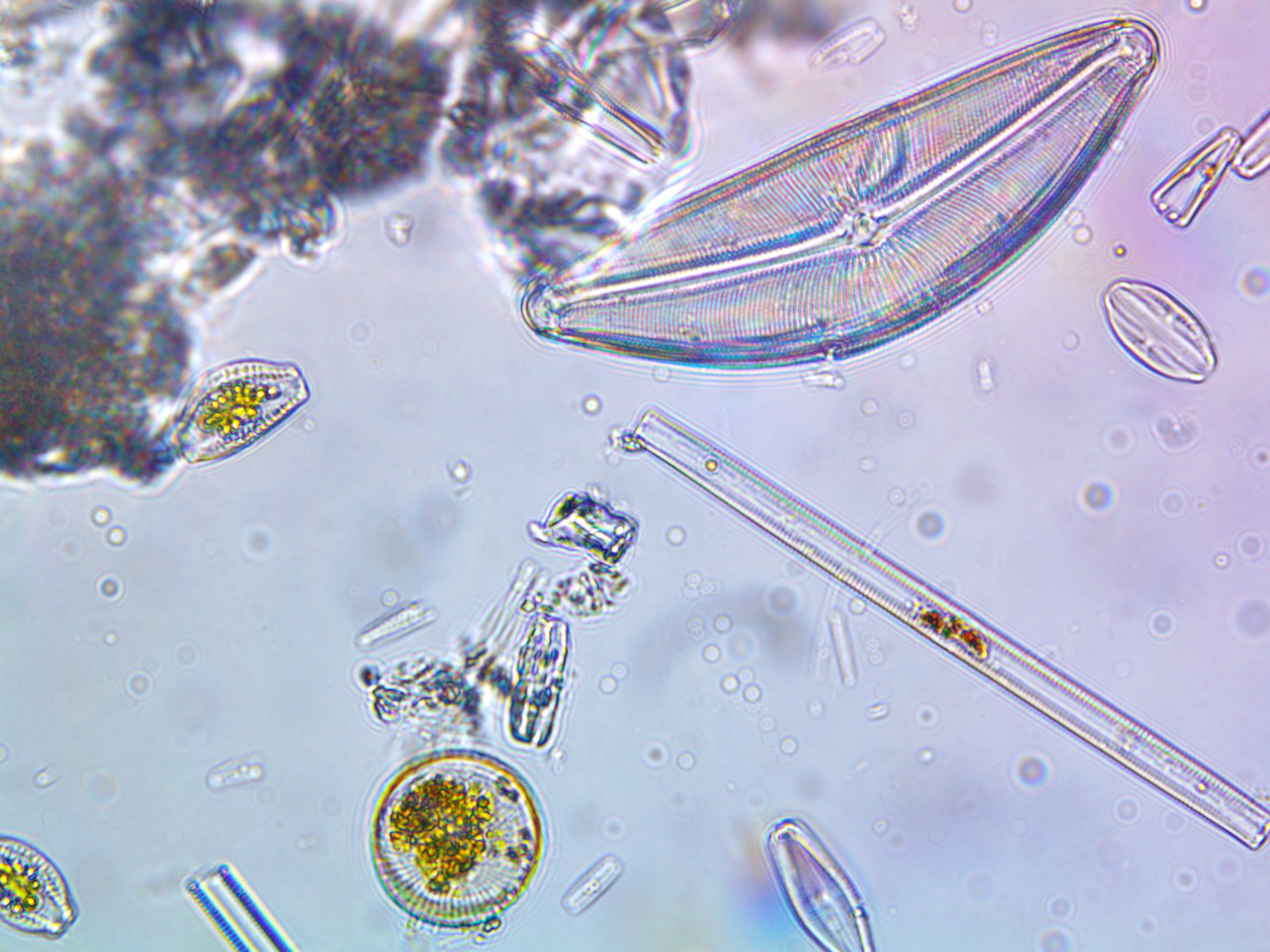
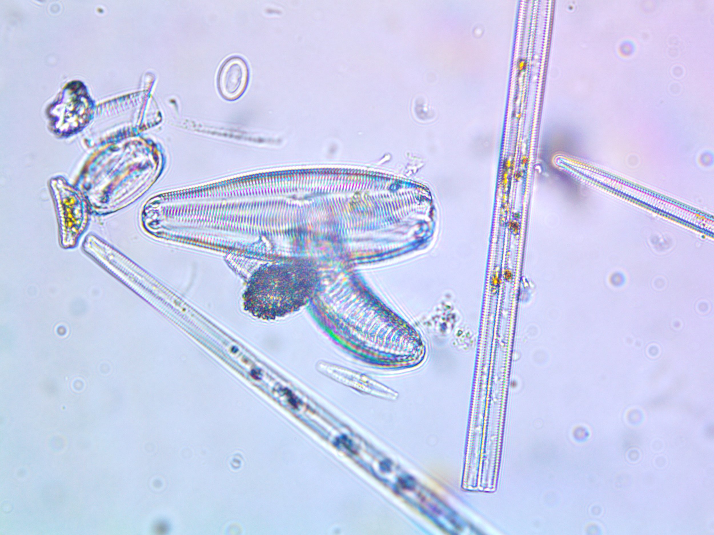
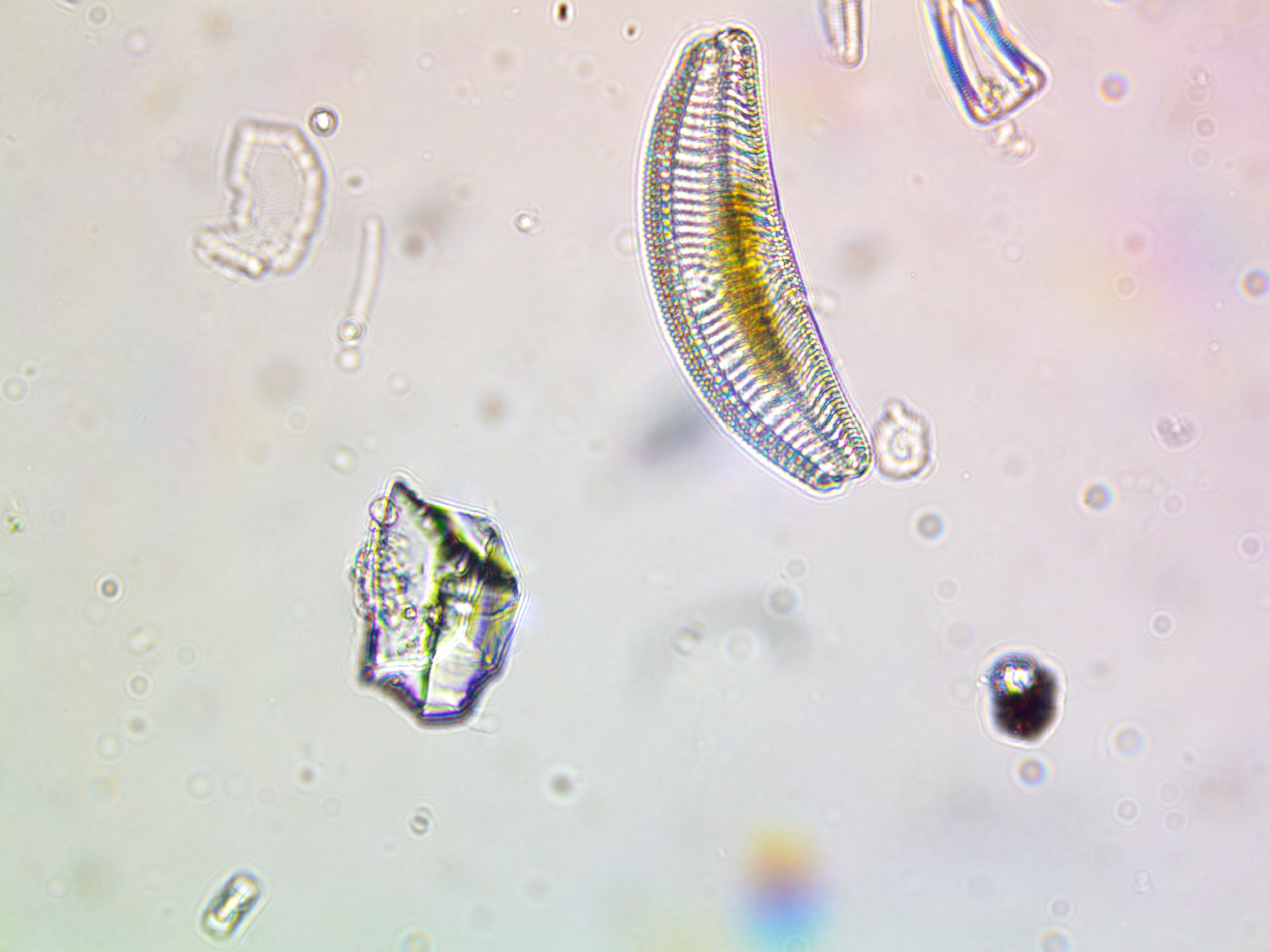
I was surprised and delighted to see observe many of the same organisms as depicted in the illustration. I worked from a live water sample, so my observations included many other organisms. The observations were so similar I was confident I had found the correct location.
